Bergville
Town · Ward 11 of Okhahlamba · KwaZulu-Natal
Who governs this spot
- Ward, 2026 boundaries
- Ward 11 52305011
- Before 4 November 2026
- The same ward number, on the 2021 lines
- Municipality
- Okhahlamba
- District
- Uthukela
- Province
- KwaZulu-Natal
The ward is the one this point falls in under the 2026 boundaries, in force from 4 November 2026.
Source: Municipal Demarcation Board, ward and municipal boundaries, simplified. The ward lookup
Weather in this ward
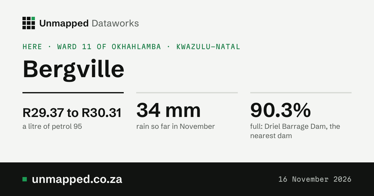
34 mmrain so far in November (1 to 5 November)
128 mma normal November, all month
31.0 °Chottest day this month, 4 November
Tallest 233 mm
NDJFMAMJJASO
Show the numbers
| When or what | Figure |
|---|---|
| Nov 2025 | 189 mm, normal 128 mm |
| Dec 2025 | 233 mm, normal 178 mm |
| Jan 2026 | 100 mm, normal 181 mm |
| Feb 2026 | 169 mm, normal 150 mm |
| Mar 2026 | 109 mm, normal 118 mm |
| Apr 2026 | 50 mm, normal 57 mm |
| May 2026 | 25 mm, normal 22 mm |
| Jun 2026 | 16 mm, normal 15 mm |
| Jul 2026 | 9 mm, normal 17 mm |
| Aug 2026 | 27 mm, normal 29 mm |
| Sep 2026 | 124 mm, normal 40 mm |
| Oct 2026 | 30 mm, normal 97 mm |
The last twelve full months brought 1,081 mm; a normal year has 1,031 mm. Hottest days of the last year: 33.0 °C on 31 October 2026, 32.7 °C on 17 October 2026 and 32.0 °C on 26 January 2026.
Weather here is averaged over a 9 km grid; this ward overlaps 10 grid cells, each weighted by the ward’s area in it, and its neighbours draw on some of the same cells. Modelled estimates from a weather reanalysis, averaged over the whole place: not readings from a weather station, and not a forecast. The weather model runs about five days behind the weather, so the newest day here is usually five to twelve days ago.
Source: ERA5-Land, Copernicus Climate Change Service, averaged over Ward 11 of Okhahlamba. Day by day, and every year since 1950
Greenness of this ward
0.46NDVI in October 2026
0.31a normal October, 1984 to 2020
Well above normalagainst normal
Tallest 0.68
NDJFMAMJJASO
Show the numbers
| When or what | Figure |
|---|---|
| Nov 2025 | 0.54, normal 0.38 |
| Dec 2025 | 0.61, normal 0.46 |
| Jan 2026 | 0.68, normal 0.54 |
| Feb 2026 | 0.67, normal 0.63 |
| Mar 2026 | 0.62, normal 0.61 |
| Apr 2026 | 0.58, normal 0.53 |
| May 2026 | 0.49, normal 0.44 |
| Jun 2026 | 0.38, normal 0.33 |
| Jul 2026 | 0.32, normal 0.28 |
| Aug 2026 | 0.28, normal 0.24 |
| Sep 2026 | 0.34, normal 0.26 |
| Oct 2026 | 0.46, normal 0.31 |
95% of the ward was seen through the clouds in October. A paler bar is a month seen over less than half the ward.
The greenness score (NDVI) is how green the land looks from space, from about 0 (bare ground, rock, water) to about 0.9 (dense green growth). It follows rain, season, crops and fire. A month’s figure is the mean over the whole place where the satellite saw the ground (clouds hide some).
Source: NDVI Anomaly and NDVI Climatology, Digital Earth Africa (CC BY 4.0), modified; Landsat imagery courtesy of the U.S. Geological Survey; contains modified Copernicus Sentinel data 2017 to 2026. Second reading: generated using European Union’s Copernicus Land Monitoring Service information (NDVI 300 m, version 3), modified. What we changed: we averaged Digital Earth Africa’s monthly NDVI over each 2026 ward at 240 m (its own 8 by 8 averages of the 30 m pixels) and wards up to municipalities, districts and provinces by area; CLMS’s three 10-day NDVI images a month averaged the same way.
Drought in this ward
No droughtin October 2026
+0.81the drought index
+0.33rain over 12 months, against normal
Show the numbers
| When or what | Figure |
|---|---|
| November 2024 | +0.32, no drought |
| December 2024 | −0.22, no drought |
| January 2025 | +0.01, no drought |
| February 2025 | +0.33, no drought |
| March 2025 | +0.73, no drought |
| April 2025 | +1.18, no drought |
| May 2025 | +1.30, no drought |
| June 2025 | +1.25, no drought |
| July 2025 | +0.78, no drought |
| August 2025 | +1.05, no drought |
| September 2025 | +1.52, no drought |
| October 2025 | +1.05, no drought |
| November 2025 | +1.28, no drought |
| December 2025 | +1.32, no drought |
| January 2026 | +1.12, no drought |
| February 2026 | +0.76, no drought |
| March 2026 | +0.40, no drought |
| April 2026 | +0.37, no drought |
| May 2026 | +0.34, no drought |
| June 2026 | +0.41, no drought |
| July 2026 | +0.42, no drought |
| August 2026 | +0.38, no drought |
| September 2026 | +1.21, no drought |
| October 2026 | +0.81, no drought |
<a href="/drought/ward-52305011">The ward’s drought month by month, with the dams and rain</a>
The drought index puts four measures on one scale, each in standard deviations from its 1991 to 2020 normal for the time of year (minus is drier): rain over the last 3 months and the last 12 (from ERA5-Land), rain less evaporation over 12 months (ERA5-Drought’s SPEI, so a hot, dry year counts for more), and how green the land is (from space, since 2017). The index is their mean. Rain and evaporation are modelled estimates from a weather reanalysis, averaged over the whole place, not station readings; greenness is measured from space. This is not an official drought declaration: those come from the National Disaster Management Centre.
Source: Contains modified Copernicus Climate Change Service information 1950 to 2026 (ERA5-Land, for rain; ERA5-Drought, for SPEI). Neither the European Commission nor ECMWF is responsible for any use that may be made of the Copernicus information or data it contains. Greenness: NDVI Anomaly, Digital Earth Africa (CC BY 4.0), modified; Landsat imagery courtesy of the U.S. Geological Survey; contains modified Copernicus Sentinel data 2017 to 2026.
Fire in this ward
120fire detections, the twelve months to October 2026
0.0 haburnt in 7 of those months
Show the numbers
| When or what | Figure |
|---|---|
| November 2025 | 0 fire detections |
| December 2025 | 0 fire detections |
| January 2026 | 0 fire detections |
| February 2026 | 0 fire detections |
| March 2026 | 0 fire detections |
| April 2026 | 0 fire detections |
| May 2026 | 0 fire detections |
| June 2026 | 10 fire detections |
| July 2026 | 23 fire detections |
| August 2026 | 53 fire detections |
| September 2026 | 28 fire detections |
| October 2026 | 6 fire detections |
| November 2025 | 0.0 ha burnt (0.000% of the place) |
| December 2025 | 0.0 ha burnt (0.000% of the place) |
| January 2026 | 0.0 ha burnt (0.000% of the place) |
| February 2026 | 0.0 ha burnt (0.000% of the place) |
| March 2026 | 0.0 ha burnt (0.000% of the place) |
| April 2026 | 0.0 ha burnt (0.000% of the place) |
| May 2026 | 0.0 ha burnt (0.000% of the place) |
| June 2026 | not out yet |
| July 2026 | not out yet |
| August 2026 | not out yet |
| September 2026 | not out yet |
| October 2026 | not out yet |
The worst years since 2012: 2021 (235 detections), 2023 (204 detections), 2022 (182 detections).
<a href="/fire/ward-52305011">The ward’s fires month by month, and every year since 2012</a>
Hot spots seen from space by VIIRS (NASA FIRMS) and ground that looks burnt afterwards (Copernicus, 300 m); not fires reported on the ground.
Source: Fire detections: we acknowledge the use of data and/or imagery from NASA’s Fire Information for Resource Management System (FIRMS), part of NASA’s LANCE (VIIRS 375 m, S-NPP and NOAA-20). Burnt area: generated using European Union’s Copernicus Land Monitoring Service information (Burnt Area 300 m version 4, DOI 10.2909/8fa58061-28ab-49bb-9b77-c26b50733e34), modified; this does not mean the European Union endorses us.
Air in Okhahlamba
6.4 µg/m³nitrogen dioxide near the ground, 2025’s mean
10 µg/m³in winter (4.1 µg/m³ in summer)
Air in 2025 (modelled): nitrogen dioxide near the ground averaged 6.4 µg/m³, under WHO’s guideline of 10; winters 10 µg/m³, summers 4.1 µg/m³.
<a href="/air/okhahlamba">Okhahlamba’s air month by month since 2003</a> · <a href="/air">every municipality ranked</a>
Modelled, not measured: these figures come from the Copernicus Atmosphere Monitoring Service’s reanalysis, a weather and chemistry model that takes in satellite readings. Its cells are about 80 km across, so a busy road or a smoky winter evening in one suburb is smoothed into the region around it. It is not a reading at any address.
Source: Contains modified Copernicus Atmosphere Monitoring Service information 2003 to 2025. Neither the European Commission nor ECMWF is responsible for any use that may be made of the Copernicus information or data it contains.
Conditions in October 2026
October 2026: 30 mm of rain (normal 97 mm), hottest day 33.0 °C, greenness well above normal, no drought, 6 fire detections.
- Rain30 mm 31% of normalNormal 97 mm. Source: rainfall and temperature by ward, release of 5 November 2026.
- Hottest day33.0 °C0 days of 35 °C or more. Source: rainfall and temperature by ward, release of 5 November 2026.
- Greenness0.46 well above normalNormal 0.31. 95% of the place seen. Source: greenness by ward, release of 12 November 2026.
- DroughtNo drought index +0.81Steps from normal: 0 is normal, −1 is dry, −2 is very dry. Source: drought monitor by ward and municipality, release of 12 November 2026.
- Fire detections6 20% of the usual OctoberNormal 30. Burnt area for October 2026 not out yet (it comes some weeks after). Source: burnt area and fire by ward, release of 12 November 2026.
- Surface water (2025, yearly)12.7 km² 123% of the 1991 to 2020 averageNormal 10.3 km². 11.7 km² permanent; 93% of the place seen. Source: surface water by ward, release of 12 November 2026.
- Dams that supply the placeNot linked yetWe hold every dam’s level (DWS) but no link yet between a dam and the places it supplies. Open Dams that supply the place
- AirNot out yetOur air figures (modelled, by municipality) come from a yearly reanalysis that reaches the end of last year, not this month. Open Air
Built only from our live releases. A gap is a gap: we show what we do not hold rather than fill it in. Rain and heat are worked out by a weather model; greenness, drought’s greenness part and fire are seen from space.
Sources, releases and how to cite
Rain: rainfall and temperature by ward, record ward-52305011-2026, release 2026-11-05.2. In the API (with a key): /v1/datasets/weather-by-ward/records?level=ward&code=52305011&year=2026
Hottest day: rainfall and temperature by ward, record ward-52305011-2026, release 2026-11-05.2. In the API (with a key): /v1/datasets/weather-by-ward/records?level=ward&code=52305011&year=2026
Greenness: greenness by ward, record ward-52305011-2026, release 2026-11-12. In the API (with a key): /v1/datasets/greenness-by-ward/records?level=ward&code=52305011&year=2026
Drought: drought monitor by ward and municipality, record ward-52305011-2026, release 2026-11-12. In the API (with a key): /v1/datasets/drought-index/records?level=ward&code=52305011&year=2026
Fire detections: burnt area and fire by ward, record ward-52305011-2026, release 2026-11-12. In the API (with a key): /v1/datasets/wildfire-history/records?level=ward&code=52305011&year=2026
Surface water (2025, yearly): surface water by ward, record ward-52305011, release 2026-11-12. In the API (with a key): /v1/datasets/surface-water-by-ward/records?level=ward&code=52305011
Each figure from the live release named beside it.
Land and people in this ward
11,300people in 2026, modelled
1.42 km²built-up in 2020, 0.4% of the ward
62.5%grassland in 2021
- grassland 63%
- cropland 23%
- shrubland 7.4%
- trees 3.3%
- open water 3.1%
- built-up 0.8%
Highest 1.42 km²Lowest 0.36 km²
197510 readings, every five years2020
Show the numbers
| When or what | Figure |
|---|---|
| 2020 | 1.42 km² |
| 2015 | 1.23 km² |
| 2010 | 1.05 km² |
| 2005 | 0.91 km² |
| 2000 | 0.80 km² |
| 1995 | 0.68 km² |
| 1990 | 0.60 km² |
| 1985 | 0.50 km² |
| 1980 | 0.42 km² |
| 1975 | 0.36 km² |
Highest 11,300Lowest 9,830
201512 years, one a year2026
Show the numbers
| When or what | Figure |
|---|---|
| 2026 | 11,300 |
| 2025 | 11,200 |
| 2024 | 11,100 |
| 2023 | 10,900 |
| 2022 | 10,800 |
| 2021 | 10,700 |
| 2020 | 10,500 |
| 2019 | 10,300 |
| 2018 | 10,200 |
| 2017 | 10,000 |
| 2016 | 10,100 |
| 2015 | 9,830 |
Built-up area: 0.36 km² in 1975, 1.42 km² in 2020. About 9,830 people in 2015 and 11,300 in 2026. A second model (GHS-POP) puts 2020 at about 7,710, against WorldPop’s 10,500: the two differ by more than a fifth here, so read either with care.
The two built-up figures measure different things: land cover counts every 10 m square that is mostly built on, roads and gardens between the roofs included; built-up area counts only the roofs and paved ground themselves, so it is the smaller. People are a modelled estimate (WorldPop), not the census; GHS-POP is a second model. Built-up area is what the satellite sees, roofs and paved ground; it says nothing about who lives there or how. Shown for the ward as a whole, year by year; we do not name or outline any settlement.
Source: ESA WorldCover 2021 (CC BY 4.0), modified. GHSL, European Commission Joint Research Centre (CC BY 4.0), modified. WorldPop (www.worldpop.org), CC BY 4.0, modified. What we changed: we added up each grid’s 10 m or 100 m cells inside every 2026 ward (MDB boundaries; a cell belongs to the ward holding its centre) and added wards up to municipalities, districts and provinces.
Petrol here
R29.37 to R30.31a litre of petrol 95, province range
R29.00 to R29.94a litre of petrol 93
Highest R29.38Lowest R18.82
Nov 202160 changes keptToday
Show the numbers
| When or what | Figure |
|---|---|
| 4 November 2026 | R29.37 |
| 7 October 2026 | R29.38 |
| 2 September 2026 | R26.05 |
| 5 August 2026 | R24.71 |
| 1 July 2026 | R25.23 |
| 3 June 2026 | R27.19 |
| 6 May 2026 | R25.76 |
| 1 April 2026 | R22.49 |
| 4 March 2026 | R19.47 |
| 4 February 2026 | R19.27 |
| 7 January 2026 | R19.92 |
| 3 December 2025 | R20.58 |
| 5 November 2025 | R20.29 |
| 1 October 2025 | R20.80 |
| 3 September 2025 | R20.72 |
| 6 August 2025 | R20.76 |
| 2 July 2025 | R21.04 |
| 4 June 2025 | R20.52 |
| 7 May 2025 | R20.57 |
| 2 April 2025 | R20.79 |
| 5 March 2025 | R21.55 |
| 5 February 2025 | R21.62 |
| 1 January 2025 | R20.80 |
| 4 December 2024 | R20.68 |
| 6 November 2024 | R20.51 |
| 2 October 2024 | R20.26 |
| 4 September 2024 | R21.40 |
| 7 August 2024 | R22.32 |
| 4 July 2024 | R22.47 |
| 5 June 2024 | R23.46 |
| 1 May 2024 | R24.70 |
| 3 April 2024 | R24.33 |
| 6 March 2024 | R23.73 |
| 7 February 2024 | R22.52 |
| 3 January 2024 | R21.77 |
| 6 December 2023 | R22.53 |
| 1 November 2023 | R23.18 |
| 4 October 2023 | R24.96 |
| 6 September 2023 | R23.82 |
| 2 August 2023 | R22.11 |
| 5 July 2023 | R21.74 |
| 7 June 2023 | R21.91 |
| 3 May 2023 | R22.62 |
| 5 April 2023 | R22.25 |
| 1 March 2023 | R22.30 |
| 1 February 2023 | R21.03 |
| 4 January 2023 | R20.75 |
| 7 December 2022 | R22.81 |
| 2 November 2022 | R22.22 |
| 5 October 2022 | R21.71 |
| 7 September 2022 | R22.73 |
| 3 August 2022 | R24.77 |
| 6 July 2022 | R26.09 |
| 1 June 2022 | R23.52 |
| 4 May 2022 | R21.09 |
| 6 April 2022 | R21.24 |
| 2 March 2022 | R20.88 |
| 5 January 2022 | R18.89 |
| 1 December 2021 | R19.57 |
| 3 November 2021 | R18.82 |
From 4 November 2026. Down R0.01 on the month before. This is the range across the 13 fuel zones of KwaZulu-Natal, not one price for this spot. No source we hold says which magisterial districts Okhahlamba lies in, so we can’t name its zone yet. The next change is due on 2 December 2026. The graph is zone 1A.
Source: Government Gazette 55667 of 3 November 2026; zones from National Treasury’s list of magisterial districts. The fuel tool
Electricity here
Eskomelectricity supplier
Okhahlamba is not a licensed distributor, so homes here buy from Eskom directly. Eskom’s own tariffs are not in our data.
Tap water
2 of 14drinking water systems in Okhahlamba at high or critical risk
- OKHAHLAMBA - Bergville Town and Surrounding Rural AreasMedium risk
This is the system the Blue Drop 2024 report names for Bergville.
The rating is the Department of Water and Sanitation’s view of the risk in each system, not a test of the water in your tap.
Source: Department of Water and Sanitation, Blue Drop Progress Assessment Report 2025: KwaZulu-Natal, page 90. Tap water by town
The dams nearest
- Driel Barrage Dam6.9 km away90.3% full
- Woodstock Dam14 km away96.7% full
- Spioenkop Dam16 km away100.3% full
In a straight line from the spot. They are not necessarily the dams that supply it: we hold no link yet between a dam and the towns it supplies. 3 of the dams in the weekly report have no position in our records and are left out.
Source: Department of Water and Sanitation, weekly State of Dams, 9 November 2026; positions from © OpenStreetMap contributors, ODbL 1.0. Every dam
The toll plazas nearest
- Bergville RampN3 · 30 km awayR30.00 for a car
- Tugela MainlineN3 · 36 km awayR100.00 for a car
- Tugela East RampN3 · 37 km awayR62.00 for a car
In a straight line. Class 1 (a car), tariffs for 2026/27. Our records hold only tolls set by notice in the Government Gazette.
Source: toll tariff notices in the Government Gazette. Each plaza links to its notice.
What changes next
- 19 November2026Interest ratesThe Reserve Bank announces its decision. Prime is 10.75% now.
- 2 December2026PetrolThe monthly price change. Petrol 95 is from R29.37 now.
- 1 March2027TollsNext year’s toll tariffs are due about now, by Gazette notice.
Dates from each dataset’s own schedule. Every date · Add Okhahlamba’s dates to your calendar
The notices behind these figures
- Petrol 95Government Gazette 55667 of 3 November 2026
- Toll, Bergville plaza on the N3Government Gazette 54087, Notice 7098, page 22
- Minimum wageGovernment Gazette 54075, Notice R. 7083, page 4
- Prime lending rateRepo rate announced by the Reserve Bank, plus 3.5 points (the banks’ convention), in effect 25 September 2026
- The randEuropean Central Bank, euro reference rates of 13 November 2026
Each notice page lists every figure the notice set, with the page it is printed on.